Local Bike Trails

Local Bike Trails
We have gathered some local bike trail maps for your pleasure.
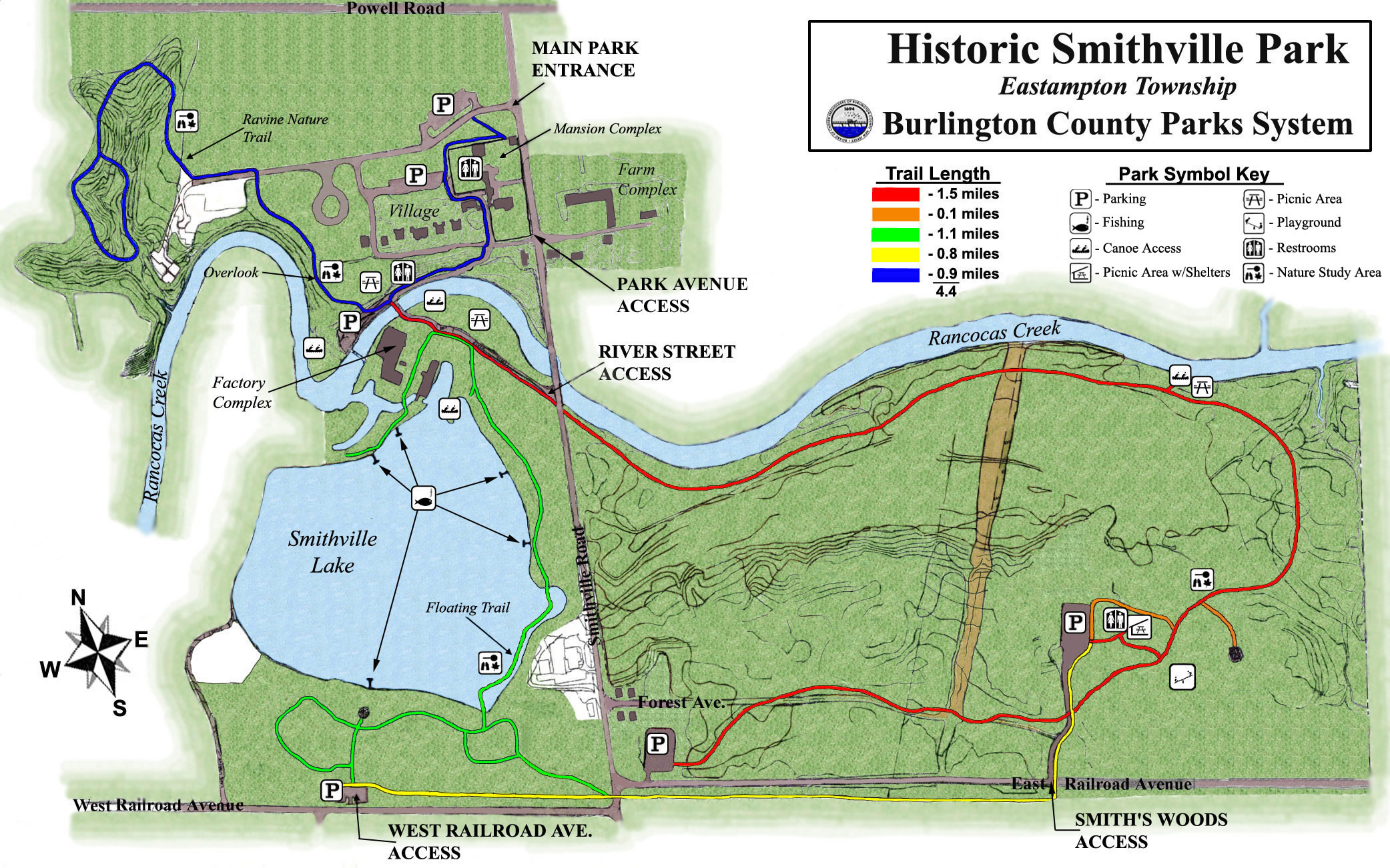
Historic Smithville Park, Eastampton Township, NJ
This trail is a 3.3-mile loop trail near Eastampton, New Jersey, with the total mileage in trails at 4.4 miles. This is considered a generally easy route, only taking about an hour to complete. This is a very popular area for hiking, mountain biking, and running, so you'll likely encounter other people while exploring.
CLICK HERE FOR DIRECTIONS TO SMITHVILLE
Historic Batsto Village, Wharton State Forest, Hammonton, NJ
Below are a few maps of the Batsto Village area, which is filled with many trails varying in distance and experience level.
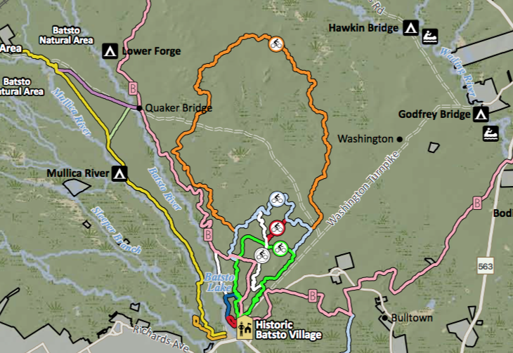
The orange trail on the map is the Penn Branch Trail. This is an 18-mile trail dedicated towards all terrain riding and mountain biking that runs through the heart of the NJ Pine Barrens. The Penn Branch Trail is the longest trail dedicated towards mountain biking in the state of NJ.
Routes with this trail
Blue Route Loop, Batsto Huckleberry Trail: 8 miles
Orange Trail Loop, Penn Branch Trail: 18 miles
Green Trail Loop, Fire Tower Trail: 5.7 miles
WhiteTrail- Oak Hill Trail, Northern Half: 4,252 feet
Oak Hill Trail, Southern Half: 1 mile
Red Trail, Batsto Teaberry Trail: 3,458 feet
Below is a zoomed in picture of the Green Trail Loop, Fire Tower Trail, as highlighted in yellow.
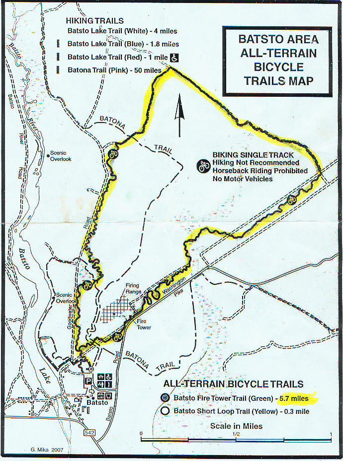
The following map is a terrain map of the Penn Branch Trail. This MTB trail is a more difficult trail, meant for experienced riders.
CLICK HERE FOR DIRECTIONS TO BATSTO VILLAGE
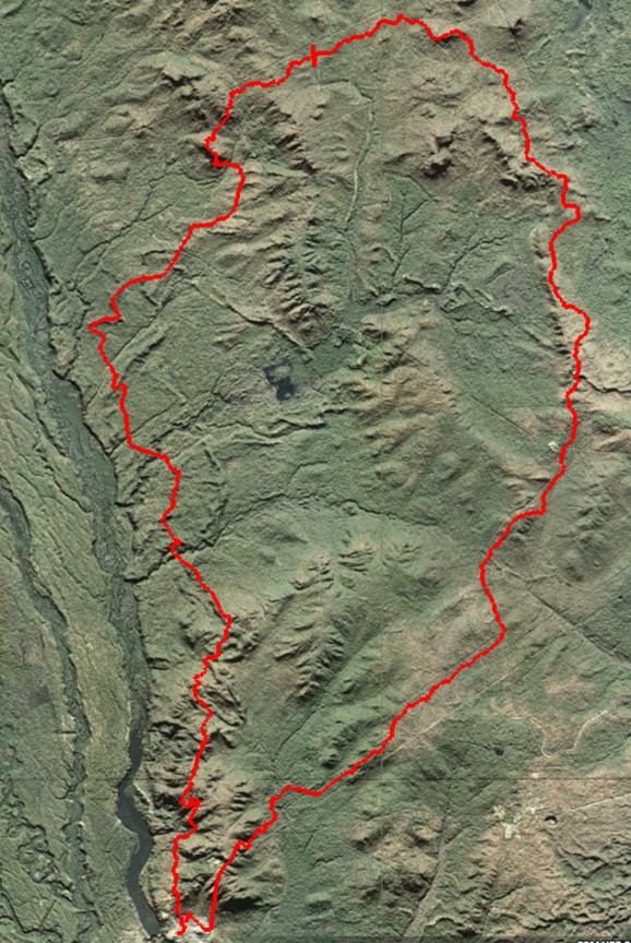
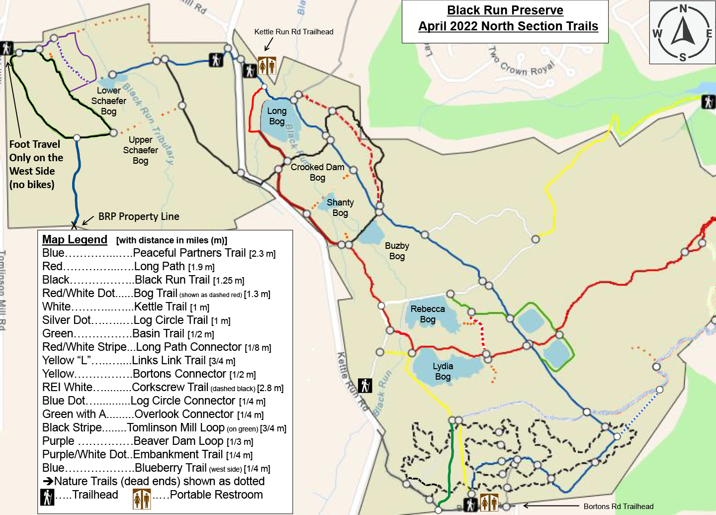
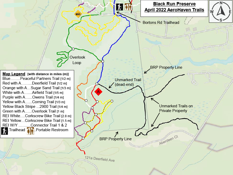
Black Run Preserve, Marlton, NJ
Black Run Preserve is located behind King's Grant in Marlton, NJ. It offers varying levels of difficulty and terrain with minimal elevation. Some sugar sand to be expected to encounter. Please see the detailed map legend for trail distance and entrance points.
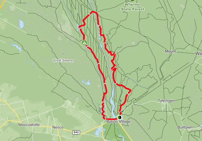
Mullica River and Batona Trail Loop, Wharton State Forest, near Hammonton, NJ
This is a 13-mile trail loop, known for camping, fishing, and hiking. Beware of rumored unfinished bridge- you may have to make a detour.
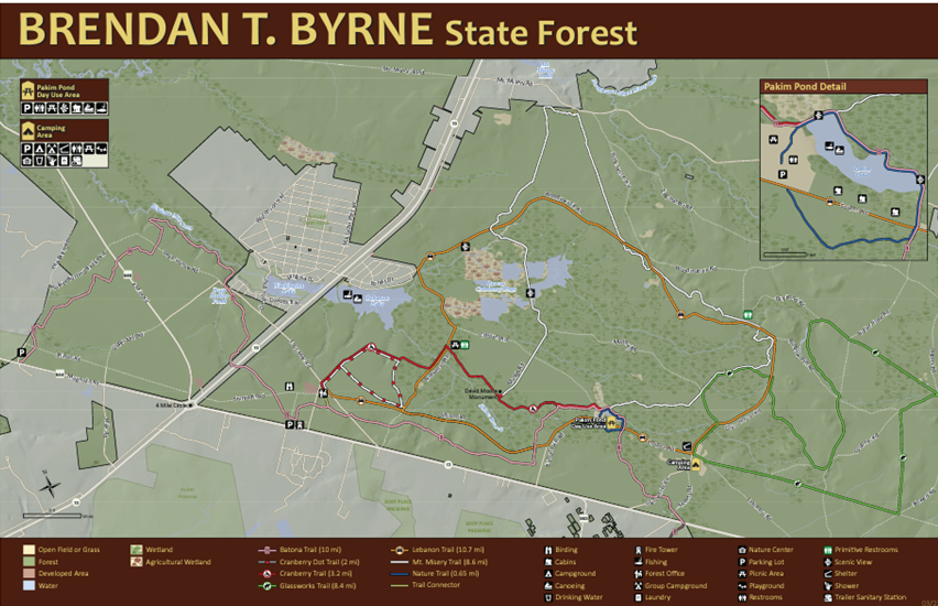
Brendan T. Byrne State Forest Area Maps, Pine Barrens, NJ
The map below details the large area that is Brendan T. Byrne State Forest. Please see map key/legend for trail information and access points. Offering over 38,000 acres centered in the heart of the pines, boasting more than 25 miles of marked trails. This area is sure to please any bike trail enthusiast. The Batona Trail, approximately 50 miles in length and running through Brendan T. Bryne State forest, joining the Wharton and Bass River State Forests.
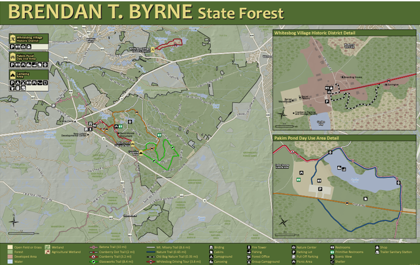
Pictured below is the trail map.
Brendan Byrne Forest Loop, Brendan Byrne State Forest, near Chatsworth, NJ
This trail loop is an 8.6-mile trial, that is moderately challenging. Great for mountain biking, or gravel bikes with wider tires.
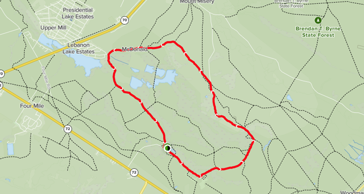
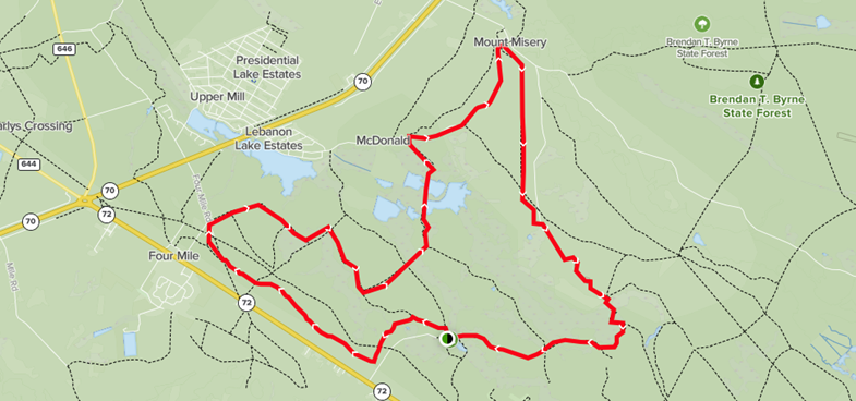
Pakim Pond Trail Loop- Mount Misery Trail, near Chatsworth, NJ
This trail is a 13.5 mile, moderately challenging trail loop located in the heart of the NJ Pine Barrens.